Your assets, where they actually live
Every asset you manage exists in a physical location. A section of pipe beneath a road. A valve at a pump station. Equipment spread across a site, region, or city.
Yet in many maintenance systems, those assets appear as rows in a database, disconnected from the places where work actually happens.
The new Maintenance Connection and Esri integration changes that by bringing ArcGIS mapping directly into Maintenance Connection. Asset, equipment, and work order data are displayed in geographic context, helping teams understand where assets are, what work is occurring, and how maintenance activity is distributed across the network.
Watch the video to see it in action.
See your assets in context
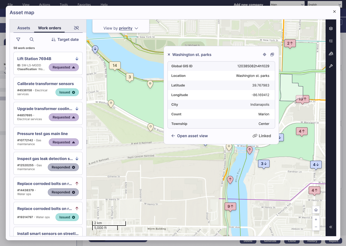
The integration displays assets directly on a map, linked to their records in Maintenance Connection.
Select any asset and instantly access maintenance key information while viewing its location within the broader network.
Instead of working and making decisions from lists and spreadsheets, teams can now see assets the way they exists in the field, from pipelines and valves, to facilities and equipment across multiple sites.
Connect maintenance data to real-world locations
Assets can be linked to their corresponding GIS features directly within the interface. Once connected, every asset maintains a relationship between its maintenance record and physical location, creating a single view of operational and spatial information.
Best of all, no GIS specialist is required. Maintenance and engineering teams now have the power to establish and manage these connections themselves.
From a map to a planning tool
Once your assets are linked, the map becomes a practical tool for planning and decisions. Load multiple locations at the same time, whether that's different sites, regions, or entire cities, and open any asset to see its details where it sits.
From the same view, your team:
- View work orders by location
- Understand asset status in context
- Identify maintenance activity across sites and regions
- Investigate assets and associated work from a single screen
- Prioritize field activity based on where work is needed
Rather than switching between systems to build a complete picture, planners and asset managers can access maintenance and location data together.
Bring spatial intelligence to your maintenance operations.
For organizations managing distributed infrastructure, location matters.
By combining Maintenance Connection with ArcGIS, teams gain a clearer understanding of their assets, work, and network. The result is faster decision-making, improved planning, and greater visibility across maintenance operations.
Book a demo to see how the Maintenance Connection and Esri integration helps maintenance teams plan, prioritize, and execute work more effectively.